octant, Benjamin Martin
Artwork Overview
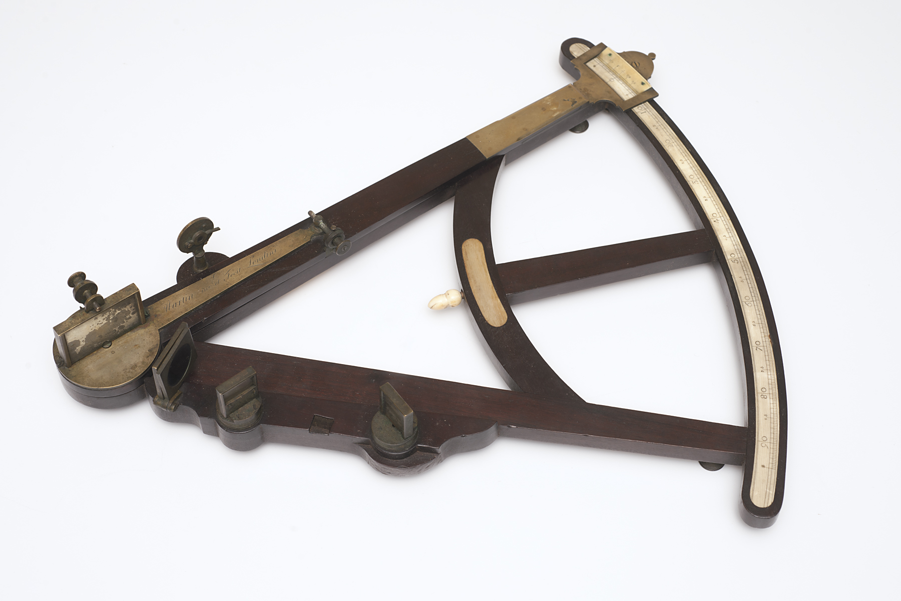
Benjamin Martin, artist
1704–1782
octant,
mid 1700s
Where object was made: England, United Kingdom
Material/technique: mahogany; brass; ivory
Credit line: Museum purchase: Friends of the Art Museum and Helen Foresman Spencer Art Acquisition Fund
Accession number: 2011.0040
Not on display
If you wish to reproduce this image, please submit an image request