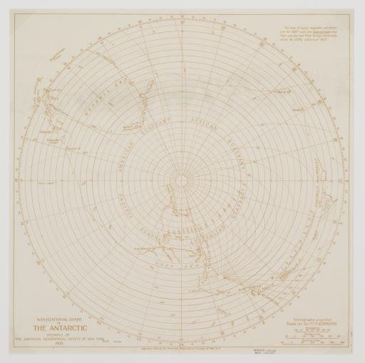
Navigational Chart of the Antarctic, American Geographical Society

Artwork Overview

American Geographical Society, Navigational Chart of the Antarctic
American Geographical Society
1928
Navigational Chart of the Antarctic, 1928
Material/technique: lithograph
Credit line: T. R. Smith Map Collection, Anschutz Library, The University of Kansas Libraries
Accession number: EL2008.044
Not on display

If you wish to reproduce this image, please submit an image request
Images

Label texts

Exhibition Label:
"Climate Change at the Poles," Jan-2009, Kate Meyer, Jennifer Talbott, and Angela Watts
Attempts were made to use airplanes in Antarctica as early as 1925 but were unsuccessful until 1928 when Australian Hubert Wilkins (1888-1958) flew over part of the continent. In 1929 American explorer Richard Byrd (1888-1957) successfully flew to the South Pole from a base his expedition had established on the Ross Ice Shelf. The publication of this navigational map in 1928 by the American Geographical Society was infinitely more likely to serve as propaganda for these popular
adventurers rather than as a practical tool for plotting a flight to Antarctica.

Exhibitions

Kate Meyer, curator
Jennifer Talbott, curator
Angela Watts, curator
2009