Geologic Map of Antarctica, American Geographical Society

Artwork Overview

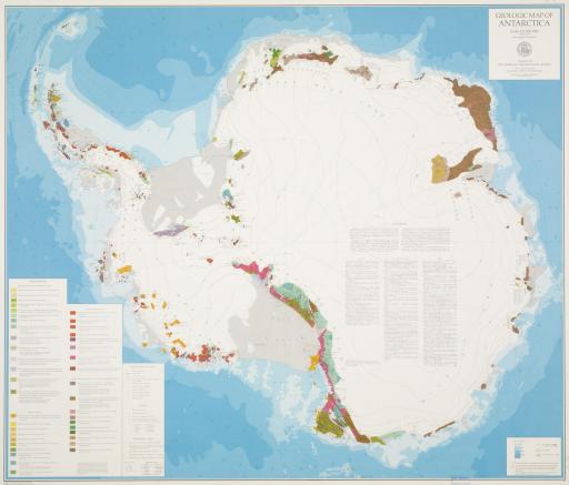
American Geographical Society, Geologic Map of Antarctica
American Geographical Society
1972
Geologic Map of Antarctica, 1972
Material/technique: screen print
Credit line: T. R. Smith Map Collection, Anschutz Library, The University of Kansas Libraries
Accession number: EL2008.046
Not on display

If you wish to reproduce this image, please submit an image request
Images

Label texts

Exhibition Label:
"Climate Change at the Poles," Jan-2009, Kate Meyer, Jennifer Talbott, and Angela Watts
Although many items on view in this gallery explore the ways in which scientists can learn about the history of Antarctica through the study of its ice, the continent’s geologic features have also garnered investigation. The age of Antarctica’s rock formations can be determined through radiometric dating (calculated by measuring the
decay rate of radioactive materials in the rock). Age can also be determined by dating fossils in the rocks, or biostratigraphy. While geologists have refined, corrected, and expanded the knowledge represented in this map from 1972, many portions of a contemporary map would still be depicted as blank spaces that remain unknown.

Exhibitions

Kate Meyer, curator
Jennifer Talbott, curator
Angela Watts, curator
2009