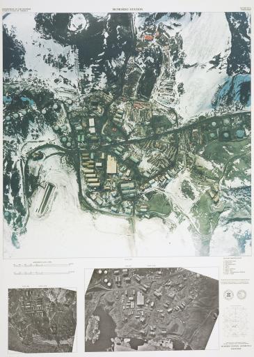
Antarctica Photomap. McMurdo Station, United States Geological Survey; National Science Foundation

Artwork Overview

Images

Label texts

Exhibition Label:
"Climate Change at the Poles," Jan-2009, Kate Meyer, Jennifer Talbott, and Angela Watts
The satellite image seen here is of McMurdo Station, the American science research station located on the southern tip of Ross Island. The largest of all the
settlements on Antarctica, the station can support more than 1,200 people and serves as the stopping point for all researchers coming and going from the South Pole Station. McMurdo was formed without a city plan, thus the layout of this ever-growing and ever-changing community is rather unstructured. Attempts are currently being made to establish a system for future development. The satellite imagery technology used to create this image in 1993 is similar to the technology that allows you to see your house on Google EarthTM today.

Exhibitions

Kate Meyer, curator
Jennifer Talbott, curator
Angela Watts, curator
2009