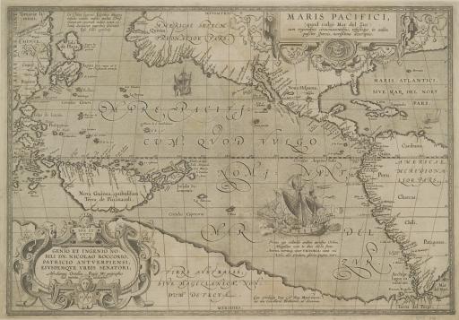
Maris Pacifici (Pacific Ocean), unknown maker

Artwork Overview

Maris Pacifici (Pacific Ocean), 1589
Material/technique: engraving
Credit line: Department of Special Collections, Kenneth Spencer Research Library, Orbis Maps 1:243
Accession number: EL2009.003
Not on display

If you wish to reproduce this image, please submit an image request
Images

Label texts

Exhibition Label:
"Climate Change at the Poles," Jan-2009, Kate Meyer, Jennifer Talbott, and Angela Watts
The ship prominently displayed in the center of the map is the Victoria; the only vessel from Ferdinand Magellan’s 1519-22 expedition to successfully circumnavigate the globe. Magellan sought a trade route to the Spice Islands (today the Maluku Islands of Indonesia) in an attempt to secure control of the spice trade for Spain. This map indicates a narrow southern passage through what would become known as the Straights of Magellan. Also Tierra del Fuego (the archipelago at the base of South America) is at this time inaccurately labeled as part of Terra Australis.

Exhibitions

Kate Meyer, curator
Jennifer Talbott, curator
Angela Watts, curator
2009