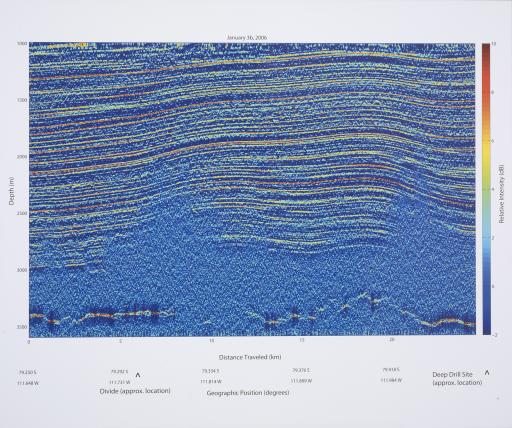
Echogram, West Antarctic Ice Sheet, Center for Remote Sensing of Ice Sheets

Artwork Overview

Echogram, West Antarctic Ice Sheet, date unknown
Material/technique: inkjet print
Credit line: Image courtesy of the Center for Remote Sensing of Ice Sheets. This material is based upon work supported by the National Science Foundation under Grant No. ANT-0424589
Accession number: EL2008.055
Not on display

If you wish to reproduce this image, please submit an image request

Images

Label texts

Exhibition Label:
"Climate Change at the Poles," Jan-2009, Kate Meyer, Jennifer Talbott, and Angela Watts
This echogram represents a cross-sectional image of a portion of the Western Antarctic Ice Sheet and is created from data collected by ground-based ice penetrating radar and generated by data processing software. The different colors indicate relative signal intensity change sensed by radar through the ice layers. While other ground-based radars have not been able to record detailed data below 2,000 meters (1.2 miles), CReSIS radars are able to sense internal layering past this depth almost all the way to the ice-bed interface (shown here at about 3,500 meters, or 2.1 miles).

Exhibitions

Kate Meyer, curator
Jennifer Talbott, curator
Angela Watts, curator
2009